Alert Details
Alert Information 0.0% County Coverage
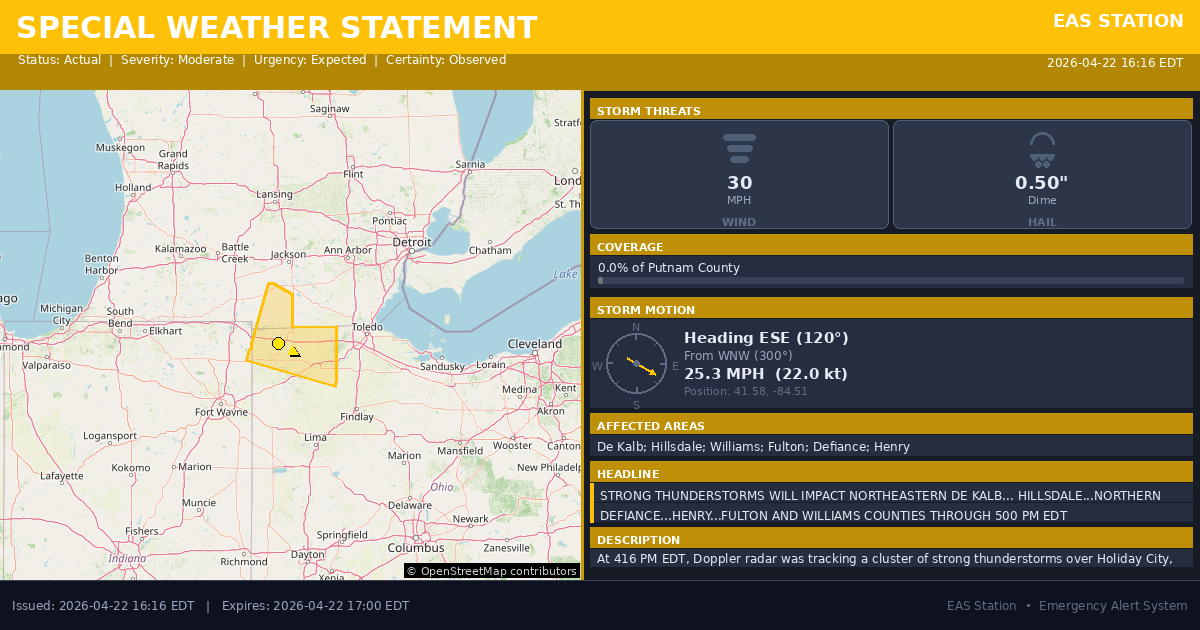
Special Weather Statement issued April 22 at 4:16PM EDT by NWS Northern Indiana
Event Type
Special Weather StatementStatus
Actual EXPIREDSeverity
ModerateUrgency
ExpectedCertainty
ObservedMessage Type
AlertDescription
At 416 PM EDT, Doppler radar was tracking a cluster of strong thunderstorms over Holiday City, or near Montpelier, moving southeast at 25 mph.
HAZARD...Winds in excess of 30 mph and half inch hail.
SOURCE...Radar indicated.
IMPACT...Gusty winds could knock down tree limbs and blow around unsecured objects. Minor hail damage to vegetation is possible.
Locations impacted include... Napoleon, Bryan, Hillsdale, Wauseon, Archbold, Montpelier, Swanton, Morenci, Delta, Jonesville, Edgerton, West Unity, Pioneer, Stryker, Fayette, Liberty Center, Edon, Mcclure, Holiday City, and Edgerton In Williams County.
This includes Interstate 80 in Ohio between mile markers 1 and 48.
Instructions
If outdoors, consider seeking shelter inside a building.
Affected Areas
018033
DeKalb County, IN
026059
Hillsdale County, MI
039171
Williams County, OH
039051
Fulton County, OH
039039
Defiance County, OH
039069
Henry County, OH
INZ009
MIZ081
OHZ001
OHZ002
OHZ004
OHZ005
This covers a small portion of emergency service districts, townships, and municipalities within the county.
Alert Coverage Map
Loading map...
Loading alert coverage map...Timing
04:16 PM EDT
05:00 PM EDT
04:18 PM EDT
06:02 PM EDT
Times in America/New_York. Auto-adjusts for daylight saving.
Technical Details
urn:oid:2.49.0.1.840.0.4d1240038ae90c57283fd8e1ee8405a0bd97debb.001.1
#532
Source times converted from NWS format to local Eastern Time.
Affected Boundaries
Localized County Impact
This alert covers 0.0% of Putnam County , affecting some emergency service boundaries.
No Boundary Intersections Found
This alert may not intersect with any configured emergency service boundaries.
NOAA Alert Details
Alert Origin
w-nws.webmaster@noaa.gov
en-US
https://api.weather.gov/alerts/active?zone=OHC003,OHZ016,OHC137,OHZ025,OHZ004,OHC039,OHZ017,OHC063,OHZ005,OHC069,OHZ015,OHC125,OHZ024,OHC161,OHZ006,OHC173
NOAA
EAS Parameters
WXR
— National Weather Service
Geocodes
018033
DeKalb County, IN
026059
Hillsdale County, MI
039171
Williams County, OH
039051
Fulton County, OH
039039
Defiance County, OH
039069
Henry County, OH
INZ009
MIZ081
OHZ001
OHZ002
OHZ004
OHZ005
INZ009
MIZ081
OHZ001
OHZ002
OHZ004
OHZ005
Event Codes
SPS
SPS
Storm Motion
Severe Threats
NWS Parameters
SPSIWX
WWUS83 KIWX 222016