Alert Details
Alert Information 0.0% County Coverage
Flood Warning issued April 22 at 10:21PM EDT by NWS Northern Indiana
Event Type
Flood WarningStatus
ActualSeverity
SevereUrgency
ImmediateCertainty
ObservedMessage Type
UpdateDescription
...The Flood Warning is extended for the following rivers in Ohio...
Tiffin River at Stryker affecting Defiance, Fulton OH and Williams Counties.
...The Flood Warning continues for the following rivers in Indiana... Michigan...
North Branch Elkhart River at Cosperville affecting Noble County.
Saint Joseph River Michigan at Three Rivers affecting Branch, Elkhart and St. Joseph MI Counties.
For the Tiffin River...including Stryker...Minor flooding is forecast. For the Elkhart River...including Goshen, Cosperville...Minor flooding is forecast.
* WHAT...Minor flooding is occurring and minor flooding is forecast.
* WHERE...Tiffin River at Stryker.
* WHEN...Until further notice.
* IMPACTS...At 13.0 feet, Flood waters begin to affect some farm buildings near Stryker and flood some secondary roads.
* ADDITIONAL DETAILS...
- At 10:15 PM EDT Wednesday the stage was 11.7 feet.
- Recent Activity...The maximum river stage in the 24 hours ending at 10:15 PM EDT Wednesday was 11.9 feet.
- Forecast...The river is expected to rise to a crest of 12.8 feet tomorrow evening.
- Flood stage is 11.0 feet.
- http://www.weather.gov/safety/flood
Instructions
Turn around, don't drown when encountering flooded roads. Most flood deaths occur in vehicles.
Detailed river forecasts and additional information can be found at www.weather.gov/iwx under Rivers and Lakes.
The next statement will be issued Thursday afternoon at 430 PM EDT.
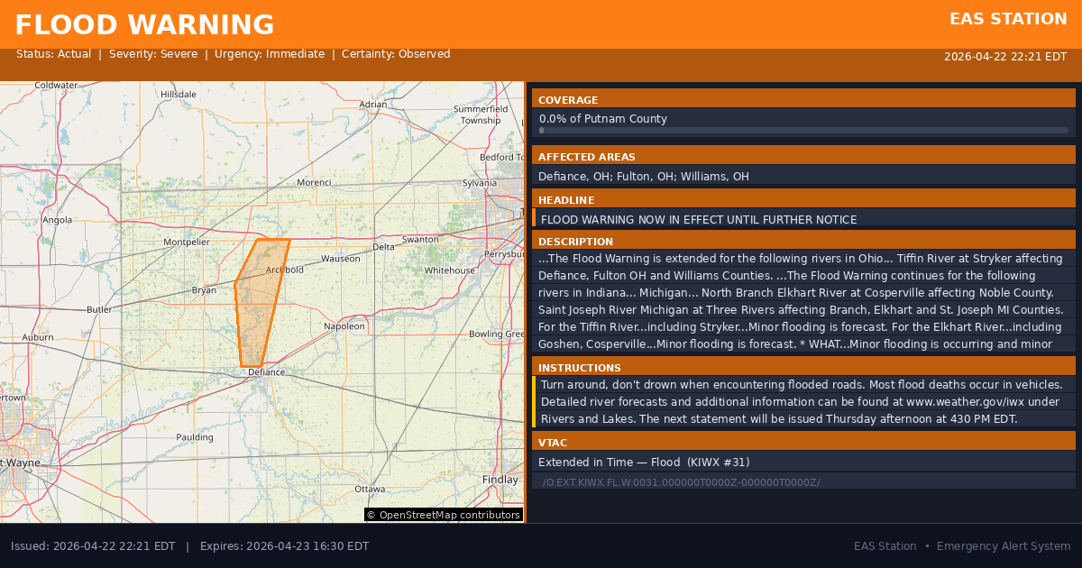
Affected Areas
039039
Defiance County, OH
039051
Fulton County, OH
039171
Williams County, OH
OHC039
OHC051
OHC171
This covers a small portion of emergency service districts, townships, and municipalities within the county.
Alert Coverage Map
Loading map...
Loading alert coverage map...Timing
10:21 PM EDT
04:30 PM EDT
10:24 PM EDT
12:11 AM EDT
Times in America/New_York. Auto-adjusts for daylight saving.
Technical Details
urn:oid:2.49.0.1.840.0.cb95f407ad89274dd21c8f6c6778e15f04643347.001.1
#548
Source times converted from NWS format to local Eastern Time.
Affected Boundaries
Localized County Impact
This alert covers 0.0% of Putnam County , affecting some emergency service boundaries.
No Boundary Intersections Found
This alert may not intersect with any configured emergency service boundaries.
NOAA Alert Details
Alert Origin
w-nws.webmaster@noaa.gov
en-US
https://api.weather.gov/alerts/active?zone=OHC003,OHZ016,OHC137,OHZ025,OHZ004,OHC039,OHZ017,OHC063,OHZ005,OHC069,OHZ015,OHC125,OHZ024,OHC161,OHZ006,OHC173
NOAA
EAS Parameters
WXR
— National Weather Service
Geocodes
039039
Defiance County, OH
039051
Fulton County, OH
039171
Williams County, OH
OHC039
OHC051
OHC171
OHC039
OHC051
OHC171
Event Codes
FLS
FLW
CAP References
urn:oid:2.49.0.1.840.0.b78bb8ea67b137b6d791154af6ae1ad8c253c376.004.1urn:oid:2.49.0.1.840.0.08c284a8c461f2993cf01cc756c41b1028ca4042.002.1VTEC
/O.EXT.KIWX.FL.W.0031.000000T0000Z-000000T0000Z/NWS Parameters
FLSIWX
WGUS83 KIWX 230221
w-nws.webmaster@noaa.gov,urn:oid:2.49.0.1.840.0.7ebc8ff6899877d20f71981b6e73e9f73d2a0bc9.005.1,2026-04-21T22:01:00-04:00 w-nws.webmaster@noaa.gov,urn:oid:2.49.0.1.840.0.ea63128b1ce109178753bdb509dcf14af871c6b4.004.1,2026-04-21T10:10:00-04:00 w-nws.webmaster@noaa.gov,urn:oid:2.49.0.1.840.0.48cd11b352773afce65c75e7e3ac6a6045896cda.004.1,2026-04-21T02:52:00-04:00 w-nws.webmaster@noaa.gov,urn:oid:2.49.0.1.840.0.013875a693476e4595a6a5eb63eb6f89f4a09beb.004.1,2026-04-20T21:22:00-04:00 w-nws.webmaster@noaa.gov,urn:oid:2.49.0.1.840.0.efeef0bd50eaff07529ea07083fa96efd6e29b9f.004.1,2026-04-20T11:49:00-04:00 w-nws.webmaster@noaa.gov,urn:oid:2.49.0.1.840.0.074318623473772df8eedecdd810680908c6ff7e.006.1,2026-04-19T22:12:00-04:00 w-nws.webmaster@noaa.gov,urn:oid:2.49.0.1.840.0.788ba9aa89c1b3151c59a9b969f5aa7c4ddacab0.008.1,2026-04-19T11:37:00-04:00 w-nws.webmaster@noaa.gov,urn:oid:2.49.0.1.840.0.ad1bf11dbbe9d1f325832ab77b03c26615dda32f.009.1,2026-04-18T21:53:00-04:00 w-nws.webmaster@noaa.gov,urn:oid:2.49.0.1.840.0.a779e5ed167c002eb89d843895cd1753b51b14ad.003.1,2026-04-18T16:09:00-04:00 w-nws.webmaster@noaa.gov,urn:oid:2.49.0.1.840.0.d1ccff6aa53abbb560468203e2ea9b597bcef463.009.1,2026-04-18T12:43:00-04:00 w-nws.webmaster@noaa.gov,urn:oid:2.49.0.1.840.0.814931b07eeb471158acfe0e11a21486165f2319.007.1,2026-04-17T22:34:00-04:00 w-nws.webmaster@noaa.gov,urn:oid:2.49.0.1.840.0.aa052b5bbf05e96a52f3d79beade99892656e544.003.1,2026-04-17T21:30:00-04:00 w-nws.webmaster@noaa.gov,urn:oid:2.49.0.1.840.0.bb2a41d20fb21a6f3fc4f00edd8afeb432a7f649.005.1,2026-04-17T11:45:00-04:00 w-nws.webmaster@noaa.gov,urn:oid:2.49.0.1.840.0.f049d8e176ecba0f0d529c1d0e016ed1084893c6.008.1,2026-04-16T11:54:00-04:00 w-nws.webmaster@noaa.gov,urn:oid:2.49.0.1.840.0.99d05b9527e8185f25c2c103ec8df36b3531b20a.001.1,2026-04-15T22:59:00-04:00 w-nws.webmaster@noaa.gov,urn:oid:2.49.0.1.840.0.3614703ac059282cf1519ace7384a308b55f3404.001.1,2026-04-15T11:08:00-04:00 w-nws.webmaster@noaa.gov,urn:oid:2.49.0.1.840.0.e4e3fded3a015ebe0451c60b140925d7b2d3c85a.001.1,2026-04-14T10:47:00-04:00