Alert Details
Alert Information 0.0%* County Coverage
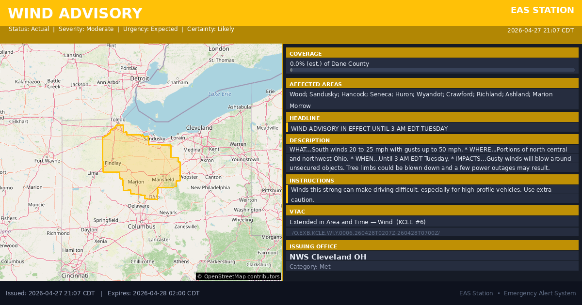
Wind Advisory issued April 27 at 10:07PM EDT until April 28 at 3:00AM EDT by NWS Cleveland OH
Event Type
Wind AdvisoryStatus
ActualSeverity
ModerateUrgency
ExpectedCertainty
LikelyMessage Type
AlertDescription
* WHAT...South winds 20 to 25 mph with gusts up to 50 mph.
* WHERE...Portions of north central and northwest Ohio.
* WHEN...Until 3 AM EDT Tuesday.
* IMPACTS...Gusty winds will blow around unsecured objects. Tree limbs could be blown down and a few power outages may result.
Instructions
Winds this strong can make driving difficult, especially for high profile vehicles. Use extra caution.
Affected Areas
039173
Wood County, OH
039143
Sandusky County, OH
039063
Hancock County, OH
039147
Seneca County, OH
039077
Huron County, OH
039175
Wyandot County, OH
039033
Crawford County, OH
039139
Richland County, OH
039005
Ashland County, OH
039101
Marion County, OH
039117
Morrow County, OH
OHZ006
OHZ008
OHZ017
OHZ018
OHZ019
OHZ027
OHZ028
OHZ029
OHZ030
OHZ036
OHZ037
This covers a small portion of emergency service districts, townships, and municipalities within the county.
Alert Coverage Map
Loading map...
Loading alert coverage map...Timing
10:07 PM EDT
03:00 AM EDT
10:08 PM EDT
11:27 PM EDT
Times in America/New_York. Auto-adjusts for daylight saving.
Technical Details
urn:oid:2.49.0.1.840.0.0dab79addd1c3441472137b8ba3381309e61178b.001.1
#566
Source times converted from NWS format to local Eastern Time.
Affected Boundaries
Localized County Impact
This alert covers 0.0% of Putnam County , affecting some emergency service boundaries.
Coverage estimated from SAME broadcast area. Recalculate intersections to use the storm polygon.
No Boundary Intersections Found
This alert may not intersect with any configured emergency service boundaries.
NOAA Alert Details
Alert Origin
w-nws.webmaster@noaa.gov
en-US
https://api.weather.gov/alerts/active?zone=OHC003,OHZ016,OHC137,OHZ025,OHZ004,OHC039,OHZ017,OHC063,OHZ005,OHC069,OHZ015,OHC125,OHZ024,OHC161,OHZ006,OHC173
NOAA
EAS Parameters
Geocodes
039173
Wood County, OH
039143
Sandusky County, OH
039063
Hancock County, OH
039147
Seneca County, OH
039077
Huron County, OH
039175
Wyandot County, OH
039033
Crawford County, OH
039139
Richland County, OH
039005
Ashland County, OH
039101
Marion County, OH
039117
Morrow County, OH
OHZ006
OHZ008
OHZ017
OHZ018
OHZ019
OHZ027
OHZ028
OHZ029
OHZ030
OHZ036
OHZ037
OHZ006
OHZ008
OHZ017
OHZ018
OHZ019
OHZ027
OHZ028
OHZ029
OHZ030
OHZ036
OHZ037
Event Codes
NWS
WIY
VTEC
/O.EXB.KCLE.WI.Y.0006.260428T0207Z-260428T0700Z/NWS Parameters
NPWCLE
WWUS71 KCLE 280207
2026-04-28T03:00:00-04:00