Alert Details
Alert Information 0.0% County Coverage
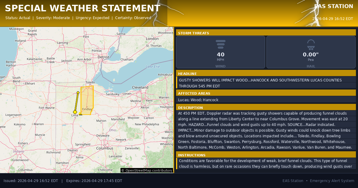
Special Weather Statement issued April 29 at 4:52PM EDT by NWS Cleveland OH
Event Type
Special Weather StatementStatus
Actual EXPIREDSeverity
ModerateUrgency
ExpectedCertainty
ObservedMessage Type
AlertDescription
At 450 PM EDT, Doppler radar was tracking gusty showers capable of producing funnel clouds along a line extending from Liberty Center to near Columbus Grove. Movement was east at 20 mph.
HAZARD...Funnel clouds and wind gusts up to 40 mph.
SOURCE...Radar indicated.
IMPACT...Minor damage to outdoor objects is possible. Gusty winds could knock down tree limbs and blow around unsecured objects.
Locations impacted include... Toledo, Findlay, Bowling Green, Fostoria, Bluffton, Swanton, Perrysburg, Rossford, Waterville, Northwood, Whitehouse, North Baltimore, McComb, Weston, Arlington, Arcadia, Rawson, Vanlue, Van Buren, and Maumee.
Instructions
Conditions are favorable for the development of weak, brief funnel clouds. This type of funnel cloud is harmless, but on rare occasions they can briefly touch down, producing wind gusts over 50 mph. If a funnel cloud is spotted move indoors and report your sighting to the National Weather Service.
Affected Areas
039095
Lucas County, OH
039173
Wood County, OH
039063
Hancock County, OH
OHZ003
OHZ006
OHZ017
This covers a small portion of emergency service districts, townships, and municipalities within the county.
Alert Coverage Map
Loading map...
Loading alert coverage map...Timing
04:52 PM EDT
05:45 PM EDT
04:54 PM EDT
07:12 PM EDT
Times in America/New_York. Auto-adjusts for daylight saving.
Technical Details
urn:oid:2.49.0.1.840.0.d6482cbf93574277c12593d46cec3599a556c457.001.1
#576
Source times converted from NWS format to local Eastern Time.
Affected Boundaries
Localized County Impact
This alert covers 0.0% of Putnam County , affecting some emergency service boundaries.
No Boundary Intersections Found
This alert may not intersect with any configured emergency service boundaries.
NOAA Alert Details
Alert Origin
w-nws.webmaster@noaa.gov
en-US
https://api.weather.gov/alerts/active?zone=OHC003,OHZ016,OHC137,OHZ025,OHZ004,OHC039,OHZ017,OHC063,OHZ005,OHC069,OHZ015,OHC125,OHZ024,OHC161,OHZ006,OHC173
NOAA
EAS Parameters
WXR
— National Weather Service
Geocodes
039095
Lucas County, OH
039173
Wood County, OH
039063
Hancock County, OH
OHZ003
OHZ006
OHZ017
OHZ003
OHZ006
OHZ017
Event Codes
SPS
SPS
Storm Motion
Severe Threats
NWS Parameters
SPSCLE
WWUS81 KCLE 292052